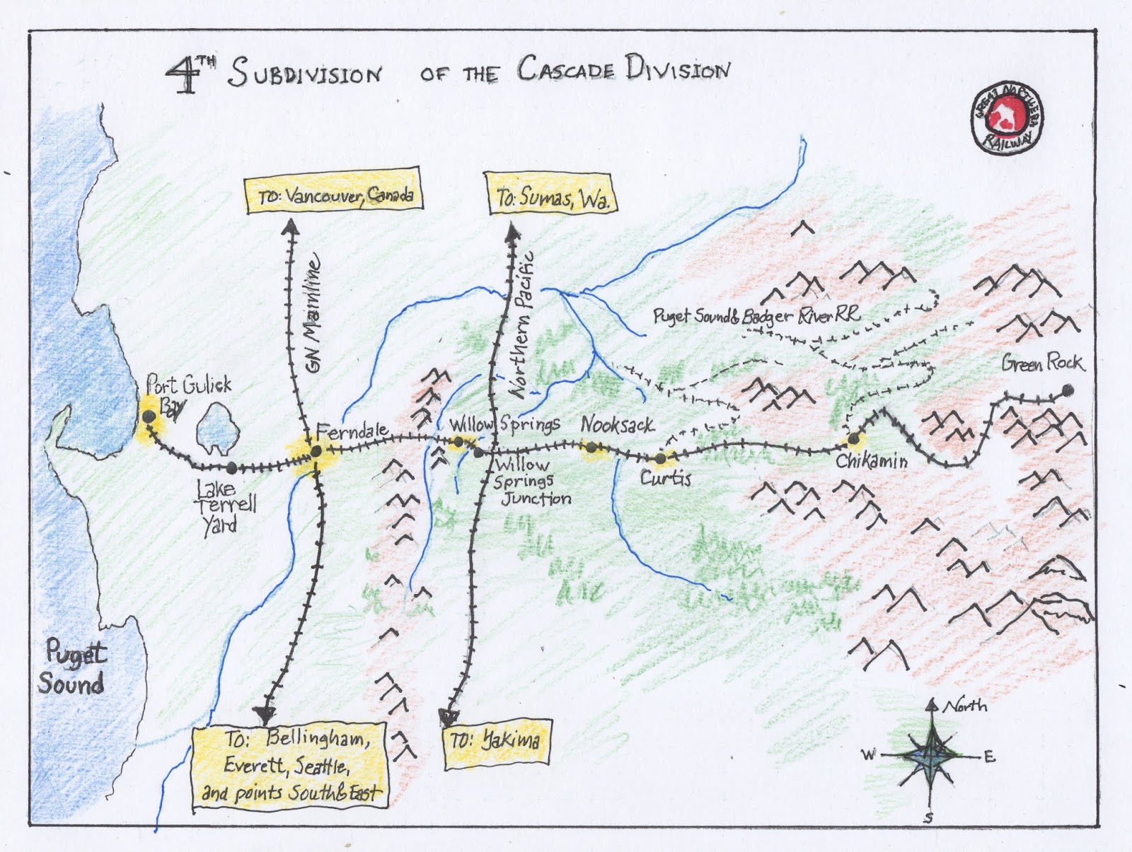
Over the last few days I sketched out this system map for the 4th Subdivision. The map puts my conceptual or mental map for the railroad down on paper. While I still intend to create a more "finished" version, I'm thinking that this sketch version may be helpful in several ways. As the 4th Subdivision is proto-freelanced, made up of a combination of real and made up locations and scenarios, I need a way to establish and convey its place in the real world to myself and others.
Whille the Cascade Division of the Great Northern Railway did not have a 4th Subdivision, the mainline between Seattle and Vancouver did cross the Nooksack River at Ferndale in Whatcom County. The Northern Pacific also ran north and south through western Whatcom County. Early in the planning of the railroad, I established its location on a map. What I hadn't done until now was to sketch out the specifics of the entire 4th Subdivision. This system map depicts the topography and distances between those parts of the subdivision that will be modeled and those that won't. It should help me in working on scenery as well as planning for operations. As operations becomes more of a possibility, a system map should provide an overview or context for visitors.
No comments:
Post a Comment